Wayfinder
Berneray Walk
Grade
ModerateType
WalkDescription
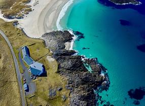
This stunning circular walk takes in views from Beinn a’Chlaidh, Loch a’ Bhaigh where you may spot common seals, Macleod’s Gunnery at Baile, the Old Telford Church and the beautiful white sands of Traigh Iar (West Beach). The walk starts and finishes at the Community Hall, Borgh, where car parking is available. To reach the hall from the causeway and ferry terminal, turn right at the main road and then left through Borgh to the end of the road. The route takes you up Beinn a’Claidh and then along the main road to Baile, and along east beach, Tràigh Bheasdaire, up Beinn Shleibhe and back to the community hall along Taigh Iar (west beach).
Walk Waypoints
- 1 Leave the Community Hall, go through a gate on your right and follow the way markers up Beinn a’ Claidh (hill of the graveyard) to the standing stone at Cladh Maolrithe. On this island of wells, Tobar Leathad Ullaraidh (the well on the slope) was renowned for its pure water and the Pabbay folk sailed over to Berneray to draw water from this well, which was used for distilling the whisky for which they were famous! Cladh Maolorithe (the standing stone) stands eight feet in height and dates back to the Bronze Age about 2000 BC. The present remains mark the site of a later church, possibly 13th century, dedicated to St Maolrubha. A more elusive place to find is Leac an Righ (flat stone of the King), a rock ledge lying about 120m south of Cladh Maolorithe. On it is the imprint of a small foot carved into the rock. Possibly Pictish, it is a much later relic than the standing stone and was used to initiate a leader into the kingship. Way markers will guide you down to the main road where you will turn left along the road.
- 2 Walk past the Borgh roadend at Pol an Oir, and on to Rubha Mhanais and in a few hundred yards past the harbour and round Loch a’Bhaigh. The harbour was completed in 1989. Before that time, boats had to ride at anchor in Loch a’Bhàigh (Bays Loch) which afforded no shelter in rough weather. Beinn Bhuirgh (Borve Hill) rises behind the harbour and the route continues along the road Cul na Beinne (Backhill) and past the Church of Scotland, built in 1887. The church marks the boundary between the two townships of Borgh and Ruisgearraidh. Keep to the right at Ruisgearraidh and follow the road to Baile. The skerries in Loch a’Bhàigh are a favourite basking place for common seals and a great place to see them. Passing Quay and Loch Bhatar Seathain, there are a number of restored thatched cottages around Laimrig (landing place). The road to the former primary school (closed in 2005) branches off to the right.
- 3 Follow the road on to Baile and here you will find the oldest surviving building on the island, MacLeod’s Gunnery. The Gunnery dates back to the 16th century and was the seat of the MacLeods of Berneray and the birthplace of Sir Norman MacLeod (16141705), the third son of Ruairidh Mor MacLeod of Harris and Dunvegan, who granted the island in life rent to his son. There is an inscription on a marble slab over the door lintel which reads: “ Hic natus est illustris ille Normanus MacLeod de Berneray eques auratus” (Here was born Sir Norman Macleod of Berneray distinguished knight).The Gunnery was a fortified building of two storeys with narrow splayed windows for defence in times of feuding with rival clans, chiefly the MacDonald’s. The house was converted into an armoury when Sir Norman moved to a bigger domicile close by, a few stones of which still remain. The walk continues along Tràigh Bheasdaire (East Beach) with views across the Sound of Harris to the Harris hills. Then follow the road along the machair for 1.3km, go through the gate and follow the way markers along the shore, keeping off the slopes of Beinn Ghainche (Sand Hill).
- 4 The Old Established Church of Scotland building stands on a rocky bluff in Lagachella. It was built in 1827, from a standard design by Thomas Telford, but had two entrances, one for the Berneray congregation and the other for the Pabbay folk. In recent years it has been sympathetically converted into a private home. Beinn Ghainche is green and fertile and on its slope you will see the old cemetery, which was used as a burial site for countless generations. Once past the fenceline, follow the waymarkers up to the summit of Beinn Shleibhe, where you can enjoy spectacular views over the Sound of Pabbay. Look for St Kilda on the western horizon, just beyond the north tip of Boreray, the island lying out to the west of Berneray. The mountains of mainland Wester Ross can be seen to the east. Descend the hill and then walk for 3.5km along the most breath-taking beach or on the dune above it.
- 5 Tràigh Iar (West Beach) is a magnificent beach almost three miles long. It is a solitary strand, where all that is usually seen of the otter are its tracks in the sand, where ravens and gulls glide above the high dunes and clumps of sea rocket grow in the summer above the high tide line. Having rounded Rubh’ a’Chorrain you walk about half the remaining distance of the beach and then turn inland to strike out in a south easterly direction across the machair, the undulating land behind the dunes, in the general direction of the Community Hall. Much of this land is flooded in winter and transformed into a network of small lochs. Turn to the left and follow the way markers for 1km across the machair to Scalabraig where you can see archaeological remains including the enigmatic Chair Stone, some of which may also have Viking associations. The route returns to the Community Hall.


