To provide you with the best experience, cookies are used on this site.  Learn more

Allow cookies

Hebridean Way Cycling Route Section C: Clachan to Berneray

Add Hebridean Way Cycling Route Section C: Clachan to Berneray to your Itinerary

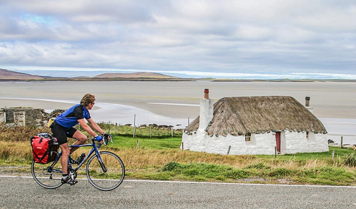
Cyclist at Sollas Cottage, Noorth Uist
  • Cyclist at Sollas Cottage, Noorth Uist
  • Cycling in the rain
  • North Uist beach
  • North Uist Cycling - Hills - Newton
  • N Uist Cycling - Hils - Newton
  • Berneray beach
  • Bikes at hostel

About

At Clachan, the route follows the road along the stunning west and north coasts of North Uist. The Route then goes northwards and over the causeway to Berneray to the ferry terminal. This part of the route is 27 miles.

NORTH UIST

After Clachan, where there is a smokehouse that sells a mouth-watering variety of local seafood, the route heads around the west side of North Uist. The Westford Inn and the Claddach Kirkibost Centre are both great places for refreshments. Further on, there are some gentle climbs and good views to the south and west. But the townships all lie at ends of side roads and the beaches and bays are hidden below the flat coastal grasslands, so it’s worth making a few detours.

The route does visit the RSPB Reserve at Balranald which is renowned for its pioneering work in re-establishing the corncrake, but you will be extremely lucky to see this secretive bird which spends most of its time hidden in vegetation. Once you get to Scolpaig Tower - a folly in a loch – you may catch a glimpse of St Kilda, 65km out in the Altantic, but don’t confuse it with Haskeir Island which is much closer inland.

The north coast of North Uist has long expanses of sand and views of the uninhabited islands of Boreray and Pabbay and beyond to the Isle of Harris.  As you enter Malacleit, there is a much photographed traditional stone cottage with overhanging thatch and supermarket around the corner at Solas. 

BERNERAY

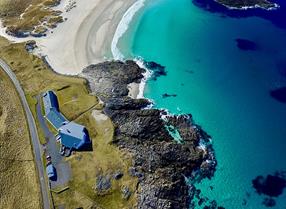
Over the causeway to Bernerary, which is the only permanently inhabited island in the Sound of Harris with a thriving community tucked in around the bays on the east side of the island.   Rich in wildlife and history and with a three mile long sweep of white sand on the west coast, it is an easy island to love. There are a couple of hostels and B&Bs on the island and there is a small shop and bistro in the village.

Map & Directions

Route Waypoints
  1. Bayhead stores ahead on the left
  2. Turn left here toward Balranald RSPB Bird Reserve and Balranald Campsite and Dunes Catering Van
  3. Turn left here
  4. Scolpaig Tower to the left
  5. Stunning tidal island of Valley to the left
  6. Supermarket nearby in Sollas and cafe
  7. Turn left here to Berneray
  8. Turn right here
  9. Take a left here
  10. Causeway 6 to Berneray. 7 islands completed, 3 to go!
  11. The end of this section in Berneray, island 8. You have two more islands to go! Hostels, B&B, shop and bistro, showers and toilets at ferry terminal

Route Guides

Route Time -

3h - 4h

Distance -

27 miles

Grade -

Moderate

Terrain -

Other

  • Route Information - Terrain - Single and Double Track Roads

Route Type -

Cycle

Along This Route

  1. Taigh Chearsabhagh Museum & Arts Centre is a place where people can meet, share ideas,…

  2. Seal viewing point

  3. Clachan Sands beach is a stunning white sandy beach which is accessible via the village…

  1. Giant Mackaskill Monument is located ti the South of Berneray.

  2. A truly stunning beach and was voted in 2021 as no. 3 in Lonely Planet's Top 20 Best…

  3. Sollas beach is a stunning white sandy beach and eaily accessible from the village of…

  4. Hosta beach is easily accessible from the main road at Hosta.

  5. Scolpaig Tower is a Georgian folly located near the village of Scolpaig.

Previous Next

Along This Route

  1. Islands: 2 (North Uist and Berneray)
    Causeways:1
    Ferries: 0
    Distance: 27 miles
    Route…

What's Nearby

  1. 5.67 miles away
  2. This Benbecula and South Uist self guided audio tour will take you to Culla Bay in…

    7 miles away
  1. Download the Uist Unearthed app and discover more about this mastery of Iron Age drystone…

    7.73 miles away
  2. Download the Uist Unearthed app and discover two sites in one at Dùn an Sticir! Watch the…

    10.02 miles away
  3. Download the Uist Unearthed app and reveal an impressive Viking longhouse, which…

    21.54 miles away
  4. Download the Uist Unearthed app and step back 2000 years ago, to explore Cill Donnain…

    22.54 miles away
  5. 23.06 miles away
  6. 24.87 miles away
  7. Download the Uist Unearthed app and step back 3500 years ago to explore conjoined Bronze…

    26.51 miles away
  8. 27.7 miles away
  9. 32.77 miles away
  10. Located just outside the gate to Eilean Glas Lighthouse, Scalpay Bothy offers shelter and…

    33.1 miles away
  11. The breath-taking views over Loch Seaforth and the chance to see native trees in an…

    36.9 miles away
Previous Next

My Planner

You can build your own holiday itinerary here! Just browse our site and click this button to add to your itinerary when you see something you like. If your planner is not finished, simply click save and you can come back to it later on! You also have the option to send your itinerary to our tailor made holiday partner.

Places to Eat

Our Islands