About
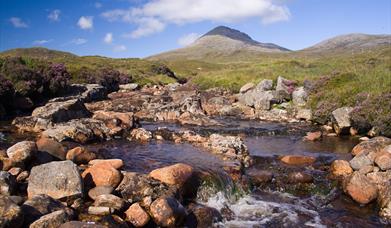
This circular walk uses the old postman's path to Rhenigidale (Reinigeadal) with it's spectacular descent of The Scriob (a series of zigzags), as a safe way down steep ground to reach Loch Trolamaraig where porpoises and divers can frequently be seen. The uninhabited Shiant Islands are visible out in The Minch with the Isle of Skye and mountains of the Scottish mainland beyond. Just after the abandoned village of Gearraidh Lotaigear, the route reaches the road near Reinigeadal - the last UK village to be reached by road in 1990 - and follows it back along a series of lochs to Eilean Anabaich with views down across the fjiord-like Loch Seaforth and into the uninhabited wilderness of the Pairc district of South East Lewis beyond. As the route turns to the west with Clisham - the highest mountain in the Outer Hebrides at 799m - domiating the skyline, good footpaths are followed back to the start.
[This walk is described in detail and illustrated with Ordnance Survey map extracts in 'Walking on Harris and Lewis' by Richard Barrett, published by Cicerone Press 2010. Unless otherwise indicated, all images used here are copyright of the author.]
A downloadable leaflet is available here.
Map & Directions
- Park in the stone walled car park and walk along the road, eastwards towards Scalpay, to reach the start of the footpath to Reinigeadal.
- Follow the footpath as it ascends besides Abhainn an t-Sratha to reach the bealach, (summit), between Beinn Tharsuinn and Trolamul.
- At the polished stone that marks where a path forks off to Mollinginish, keep right and descend The Scriob with its succession of hairpin bends to reach the bridge ath the head of Loch Trolamaraig.
- Follow the path as it ascends up and over the headland of Linginis and down to meet the road just above Reinigeadal
- Follow the road northwards along a strong of small lochs that run below the eastern slopes of Todun. Once you reach the rock cutting there are good views along Loch Seaforth and westwards to Clisham

- Opposite a dark house with few windows, follow the signpost up the hill to gain a good footpath above the southern shore of Loch Maraig.
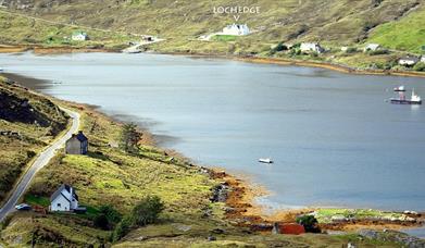
- Briefly rejoin the road around the head of Loch Maraig.
- Just before the bridge follow the path at the signpost marked for Urgha that runs along the south side of Abhainn Maraig.
- At the junction, turn southwards and follow the path southwards to Urgha. This was once the old road and is well drained throughout its length.
- At the southern end of Loch Lacasdail, the path rejoins the road bringing you back to the start of the walk.


