About
This walk has been written by Martin Margulies. The articles appeared in Am Paipear, and extracts are reproduced here with his permission. The walks have been collected together in a book, called Mhor and More.
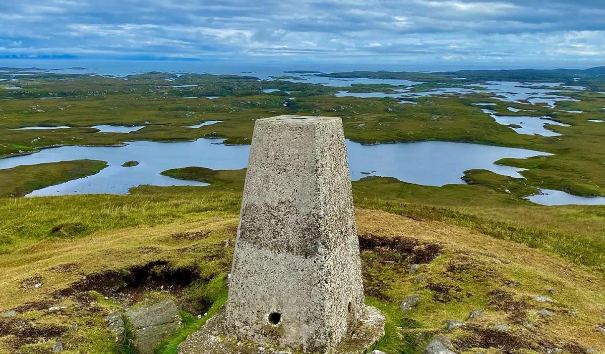
The walk begins, unpromisingly, at the island dump site, which one passes (as rapidly as possible) on the left. The digression rears up immediately afterward: Rueval, which at 124 metres (about 400 feet) is Benbecula’s tallest hill. It is worth a detour. Don’t turn off the path to climb it until you are due south of it; otherwise you will encounter boggy ground even at the driest times of year. It is at most half an hour from the path to the top. To save yourself time, do not retrace your steps going down; instead, descend via Reuval’s eastern slope. The angle is mostly gentle, and you can rejoin the path soon after reaching the bottom.
If you want to see Rossinish, though, keep going straight, along the northern branch of the pathway. The path narrows, hugging the edge of a low cliff above the water (don’t worry; it isn’t as scary as it sounds), then ends at an estuary that has no name on the ordinance map.
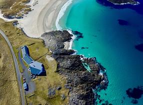
Cross over a short isthmus – the ground here rises slightly, but is easily traversable – and you will be on the peninsula. Rossinish it is flat, open and grassy, with a magnificent white sand beach on its eastern shore, well-preserved ruins of what must once have been substantial houses, and breathtaking views of North Uist.
Image: https://www.instagram.com/lmacleod_/
Map & Directions
- The walk begins, unpromisingly, at the island dump site, which one passes (as rapidly as possible) on the left.
- Follow path as it acends
- Rueval, which at 124 metres (about 400 feet) is Benbecula’s tallest hill. It is worth a detour. Don’t turn off the path to climb it until you are due south of it; otherwise you will encounter boggy ground even at the driest times of year. It is at most half an hour from the path to the top.
- Summit of Reuval (124m) Although Rueval is tiny compared to the majestic eminences of neighbouring South Uist, the terrain around it is completely flat, so your views are unimpeded on all sides. To save yourself time, do not retrace your steps going down; instead, descend via Rueval’s eastern slope. The angle is mostly gentle, and you can rejoin the path soon after reaching the bottom.
- Rejoin the path here
- Keep following the path
- If you want to see Rossinish, though, keep going straight, along the northern branch. There are some wet areas here too, and you will have to circle off the path to get around them, but you will be rewarded by impressive distant views of Eaval and the Lees on North Uist. The path narrows, hugging the edge of a low cliff above the water (don’t worry; it isn’t as scary as it sounds), then ends at an estuary that has no name on the ordinance map.
- The journey up to this point will have taken you about an hour-and-a-half, if you’ve bypassed Rueval, or two-and-a-quarter to two-and-a-half hours if you’ve climbed it. You can now either call it a day and turn back, or press on to Rossinish.
- If you press on, the best is yet to come. Cross over a short isthmus – the ground here rises slightly, but is easily traversable – and you will be on the peninsula. My first sight of it surprised me, for I had heard it described as the most desolate and isolated spot on the entire archipelago (which is why Charles skulked there whilst awaiting the finalization of his escape plans) and I had imagined it as a gloomy moonscape, covered with forbidding brown heather and saturated with bogs. But no: it is flat, open and grassy, with a magnificent white sand beach on its eastern shore, well-preserved ruins of what must once have been substantial houses, and breathtaking views of North Uist.
- Rossinish is about a mile across at its widest point, or slightly more than three miles in circumference, and despite the absence of a path you cannot get lost if you circle the coast, for eventually you will return to the isthmus. If memory serves, you can complete that circle in about two hours. Worth the additional time and effort? No doubt about it. I’m surprised Charlie could tear himself away.


