To provide you with the best experience, cookies are used on this site. Learn more

To provide you with the best experience, cookies are used on this site. Learn more


Image: https://www.instagram.com/branners55/
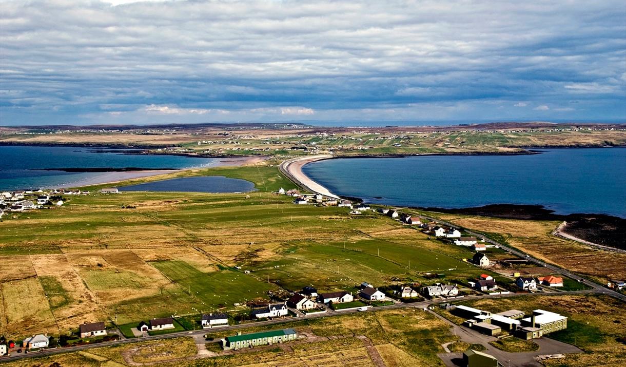
The Braighe is an isthmus - a narrow stretch of land - linking Point (Eye Peninsula) and the villages of Branahuie and Melbost. To the north of the Braighe road there is a sandy beach and to the south a pebble beach.
This is the only road connecting Point (which has a population of just over 3000) to the rest of Lewis. This road is sometimes closed in winter for short periods if there is a strong gale and high tide - the combination of both results in overlapping waves and shingle from the beach thrown on to the road. The coastguard will close the road and clear it once the gale has subsided. Our council, Comhairle nan Eilean Siar, has a Braighe camera so the road (and waves) can be monitored.
About halfway along the Braighe road, there is a small carpark on the north side where you can access the beach to the north. The north beach is generally more sheltered and great for walks.
You can also access Eaglais na h-Aoidhe and the Aignish Raiders monument from the east end of the north beach or you can access them from a carpark at the northeast end of the Braighe.
At the eastern end of the Braighe isthmus stands a striking memorial to the Aignish Farm…
Eaglais na h-Aoidhe (Church of the Eye, or isthmus) was the principal church of medieval…
Garrabost Mill is currently undergoing restoration as a historical visitor attraction and…
Busy home studio to Stornoway artist, Seonaid Clarke, where she enjoys creating detailed…
The Iolaire Monument is a memorial to those who perished on the HMY Iolaire which sunk on…
This communal burial tomb would have been an important highly visible monument of the…
Clach Ghlas (NF 5281 3340) is an enigmatic triangular standing stone 1.7 metres high,…
The Italianate Clocktower remains from the original elementary and infant school built in…
Traigh Pabail or Bayble Beach in Point is a small sandy cove with a pier, just beyond the…
A large (in island terms) social housing project for rent which fits an urban site where…
A Stornoway landmark, built in 1878. Martin’s Memorial Church was designed by RA Bryden.
The largest arts facility in the Outer Hebrides and comprises a gallery, performance…
An Lanntair’s award winning building, designed by Nicoll Russell Studios, is inspired by…
Photograph © David Wilson
The police station is off course where Detective Fin…
A downloadable guide to galleries and retail outlets where visual art and craft, made in…
A downloadable 20 page guide to Stornoway. Navigate through a detailed map featuring…