To provide you with the best experience, cookies are used on this site.  Learn more

Allow cookies

Hebridean Way Cycling Route Section D: Berneray to Tarbert

Add Hebridean Way Cycling Route Section D: Berneray to Tarbert to your Itinerary

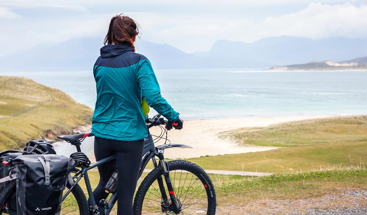
Harris: Horgabost beach
  • Harris: Horgabost beach
  • Sound of Harris ferry
  • Harris: Cyclist passing beach
  • Harris: cyclist on west coast
  • Harris: Single track road
  • Harris: cyclists looking at view of Horgabost beach

About

After the ferry ride across the Sound of Harris, where you may catch sight of seals basking  on the skerries, the route heads up the west side of South Harris with magnificent views out across sandy beaches to Taransay and the North Harris Hills. You will definitely want to linger awhile perhaps stopping off for a bite to eat at Talla na Mara. There are plenty of places to get down onto the beaches, but if you turn off the main road and ride down to Luskentyre, you will come to Tràigh Rosamul, which is perhaps the most famous with fine views and equally fine toilets.

The next part of the route consists of a steady climb on a new section of carriageway through the ‘lunar’ landscape of the interior of South Harris. If you want to extend your ride, you can drop down either of the minor roads that lead down to the rocky Bays area of South Harris and ride into Tarbert that way. Otherwise stick with the main road and enjoy the unfolding views across The Minch to Skye and the Scottish mainland.  Tarbert is the main port and village on Harris, with two hotels - Harris Hotel and Hotel Hebrides down by the pier - and plenty of places to enjoy local food, buy Harris Tweed and visit the Harris Distillery. You can take the tour of the distillery and buy some Harris gin, but you’ll have to wait awhile to sample the whisky.

Map & Directions

Route Waypoints
  1. The Anchorage restaurant to the right
  2. Takeaway to the left. Turn to the right to follow the route
  3. Turn left. Ahead on the right is a Borrisdale Tweed Welcome point.
  4. Grocery Shop to the left
  5. To the right is Hebridean Mustard Company.
  6. To the left is Croft 36 honesty shop and Seallam! Heritage Centre. There is a cafe at the end of the road.
  7. Ahead on the right is Scarista House
  8. Talla na Mara Pit Stop and cycle repair point. Cafe and Flavour chocolate shop.
  9. Campsite to the left
  10. The route is straight on, but you can take a left to the famous Luskentyre Beach.
  11. Take a right here if you want to explore the east coast - some galleries and Harris Tweed shops.
  12. On the left is a road to Ceol na Mara B&B Pit Stop
  13. Tarbert is the end of this stage. Turn right for the Isle of Harris Distillery Pit Stop with a cafe and Essence of Harris Welcome Point. There is a Hotel Hebrides and Harris Hotel with grocery shops in the village.

Route Guides

Route Time -

2.5h - 3.5h

Distance -

21 miles

Connection Transport -

Other

  • Route Information - Connection Transport - 1 ferry

Grade -

Moderate to Difficult

Terrain -

Other

  • Route Information - Terrain - Single and Double Track Roads

Route Type -

Cycle

Along This Route

  1. St Clements Church is situated in the village of Rodel, South Harris. Construction…

  2. Facing out into the Atlantic Traigh Scarasta has dramatic views over the Sound of…

  3. Traigh Seilebost is a beautiful sandy beach on the south side of Traigh Luskentyre.

  1. The beach at Luskentyre is the largest and most spectacular of all the Harris beaches.

  2. Bag Steinigidh lies between Scarasta and Borve on the west coast of Harris.

  3. Traigh Noisaboist (Nisabost) is a spectacular west coast beach with extensive views…

  4. Standing stone overlooking the beach near the village of Horgabost .

  5. The first distillery in Harris has opened it's doors. The Harris Distillery is a working…

Previous Next

Along This Route

  1. Islands: 1 (Harris)
    Causeways: 0
    Ferries: 1
    Distance: 21 miles
    Grade: Moderate to…

What's Nearby

  1. Download the Uist Unearthed app and discover two sites in one at Dùn an Sticir! Watch the…

    1.77 miles away
  2. Download the Uist Unearthed app and discover more about this mastery of Iron Age drystone…

    4.18 miles away
  3. 11.31 miles away
  1. 13.89 miles away
  2. 17.29 miles away
  3. This Benbecula and South Uist self guided audio tour will take you to Culla Bay in…

    18.76 miles away
  4. 21.82 miles away
  5. Located just outside the gate to Eilean Glas Lighthouse, Scalpay Bothy offers shelter and…

    22.58 miles away
  6. The breath-taking views over Loch Seaforth and the chance to see native trees in an…

    25.18 miles away
  7. Download the Uist Unearthed app and reveal an impressive Viking longhouse, which…

    32.9 miles away
  8. Download the Uist Unearthed app and step back 2000 years ago, to explore Cill Donnain…

    33.87 miles away
  9. Cliff Studio, located by Cliff Beach, Valtos, Uig, shows coastal landscape and abstract…

    36.39 miles away
  10. Download the Uist Unearthed app and step back 3500 years ago to explore conjoined Bronze…

    37.69 miles away
  11. 38.32 miles away
Previous Next

My Planner

You can build your own holiday itinerary here! Just browse our site and click this button to add to your itinerary when you see something you like. If your planner is not finished, simply click save and you can come back to it later on! You also have the option to send your itinerary to our tailor made holiday partner.

Places to Eat

Our Islands