Locations
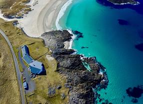
The Outer Hebrides archipelago is a unique island chain perched on the North Western edge of Europe. Here the landscape ranges from white sand beaches and flower covered machair grasslands to barren hilltops, fjord like sea lochs and vast peatlands. Wildlife is abundant and birds of prey are a particularly visible feature of the open landscapes. This map shows all the locations on the trail:
There is at least one trail location on each of the main islands in the archipelago: Lewis, Harris, North Uist, Benbecula, South Uist and Barra. All trail locations are signposted by a trail marker and some interpretation that give you specific information on the birds of prey in that area.
The trail locations include hides, a cafe and vantage points adjacent to quiet roads as well as car parks at the start of paths into the hills. The habitats vary from spectacular glacial glens in the remote North Harris hills and rugged coastlines to the tamer shores of fresh water lochs and croft land.
This section of the website will guide you through the locations on each islands, what you will find there, when to visit and how to get there. All locations are on or close to the spinal route through the islands so that you can access them easily by public transport and on foot.
Download a trail leaflet here or pick one up at one of the Welcome Points or the iCentre.
You can click on the islands below for more specific information about locations on the trail.


